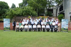
CNN Central News and Network – ITDC India Epress / ITDC News Bhopal:In celebration of National Space Day, a two-day National Workshop on “Applications of Space Technology in Forest and Wildlife Management” was inaugurated on August 21 under the aegis of the Ministry of Environment, Forest and Climate Change, Government of India, and organized by the Indian Institute of Forest Management (IIFM), Bhopal.
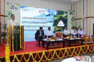
Mr. A.K. Mohanty, ADG (FC) of the Ministry of Environment, Forest and Climate Change, inaugurated the workshop and delivered the keynote address. Dr. K. Ravichandran, Director of IIFM, shared insights from his experience in using space technology to monitor marine wildlife activities and emphasized its significant role in forest and wildlife management. He highlighted that the workshop would be crucial for in-depth discussions on new developments and applications in this field.
Dr. K. Srinivas, Deputy Director of NRSC, Hyderabad, gave a technical lecture on “Earth Observation Applications and Emerging Opportunities for Forestry and Wildlife.” He discussed the utility of AI/ML systems and highlighted key web portals for data collection and monitoring, including Bhu-Nidhi, NDEM, Bhuvan, and MOSDAC. PCCF and HoFF of the Arunachal Pradesh Government, Mr. P. Subramaniam, stressed the integration of Geographic Information Systems (GIS) with field inspections. He shared his experiences and suggested that combining advanced technology with ground inspections could bring revolutionary changes in forest and wildlife management.
Rajesh S, IGF (FPD) of the Ministry of Environment, Forest and Climate Change, delivered the welcome speech and outlined the objectives of the workshop. Over the two days, 70 experts, representatives, and participants from 14 states and Union Territories, including state forest departments, national institutes specializing in natural resource management, ISRO, WII, ICFR, INCOIS, the National Disaster Management Authority (NDMA), the Ministry of Environment, Forest and Climate Change, and other academic institutions, will discuss solutions to key challenges in space technology for forest and wildlife management.
The workshop will primarily focus on how satellite imagery, remote sensing, and GIS can revolutionize conservation efforts by providing detailed data for forest areas, fire management, wildlife tracking, and protected area monitoring. It will also explore the positive potential of this technology in improving decision-making, forecasting potential issues, and facilitating timely interventions for the effective management of India’s forests and wildlife.