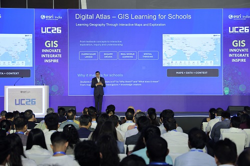
CNN Central News & Network-ITDC India Epress/ITDC News Bhopal: Esri India has launched the Digital Atlas Program, a new initiative aimed at making geography education more engaging, interactive and relevant for school students across India. Supported through ArcGIS Online, the programme is available free of cost to schools and provides curriculum-linked content along with ready-to-use learning resources.
The initiative seeks to move geography learning beyond traditional textbooks by encouraging students to explore maps, data and real-world geographic patterns. Through the programme, students can investigate relationships between people, places and the environment while developing stronger spatial-thinking and analytical skills.
According to Esri India, the objective is to encourage students to move from simply using maps to becoming map investigators and eventually knowledge creators. Teachers can use the resources to create inquiry-based classroom activities that connect geographical concepts with real-world challenges such as urban flooding, population patterns and environmental changes.
The programme builds on Esri India’s wider efforts to introduce GIS and geospatial technologies in schools and higher education. The company has previously conducted school workshops using ArcGIS Online and StoryMaps to help students create customised web maps and understand geographic information through interactive learning.
The Digital Atlas Program is expected to strengthen digital geography education and help students develop skills that can be applied to real-world challenges, technology and future careers in geospatial sciences.
Hashtags: #BusinessEconomy #Bhopal #Desksource #Esri #India #Launches #DeskSource #Digital #Atlas #Program