Rain alert for south India, fog and cold likely to increase in the north
CNN Central News & Networks / ITDC India ePress / ITDC News / Agencies, Bhopal:
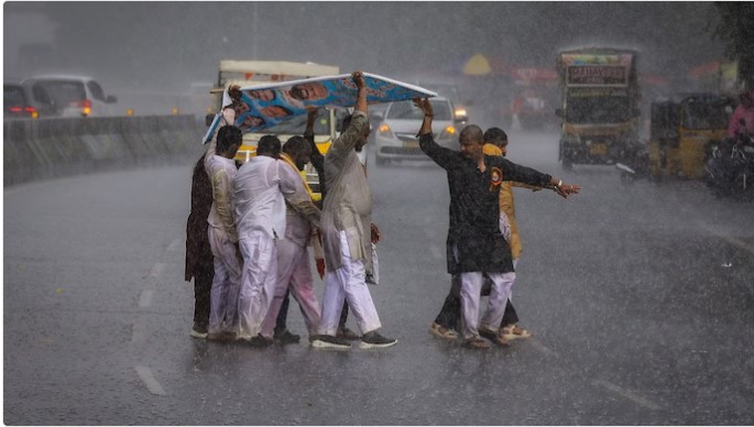
Weather patterns are changing in different parts of the country. Despite Cyclone Murasu weakening, the impact of its remnants continues in several states of south India. The India Meteorological Department (IMD) has forecast the possibility of rain on Thursday, 5 November, in Tamil Nadu, Puducherry, Karaikal, Kerala, Karnataka and parts of Andhra Pradesh. In north India, meanwhile, the weather is expected to remain mainly dry, with haze and light fog likely in the morning.
According to the weather department, heavy rain may occur in some areas of Tamil Nadu, Puducherry and Karaikal. Isolated intense rain is also likely in south interior Karnataka. Thunderstorms with lightning and strong winds are forecast in parts of coastal Andhra Pradesh and Rayalaseema. The remnants of the cyclone are gradually weakening into a low-pressure area, but rain activity may continue in the southern states because of them.
In Delhi-NCR, the sky is expected to remain mainly clear on Thursday. Light haze or fog may be seen at some places in the morning. The maximum temperature is likely to remain between 27 and 29 degrees Celsius and the minimum temperature between 15 and 17 degrees Celsius. However, the air pollution situation in the capital remains a concern, and air quality was recorded in the very poor category in the morning.
No widespread rain is likely at present in the plains of north-west India. At the same time, light rain and snowfall may occur in the western Himalayan regions in the coming days. With the change in weather, indications are that morning and night temperatures in north India may fall and the cold may increase in the days ahead.
Hashtags: #ScienceTechnology #Bhopal #South #India #Rain #Alert #North #Fog #Cold #RainAlertForSouth